

Talkeetnas
August 9-13, 2022
Until I went to the Tombstones a couple weeks later, this five day trip in the Talkeetna Mountains briefly held the title of being the best backpacking I’ve ever done. I basically did the Snowbird-Bomber-Mint traverse with some side excursions along the way (here’s probably the best map for the area). The conditions were ridiculously good for photography, which I attribute partly to luck and partly to checking the weather several times a day for a month leading up to this trip. The forecasts finally showed at least a couple days where it maybe wouldn’t rain nonstop so I packed my stuff and drove up to Hatcher Pass from Anchorage.
Day 1
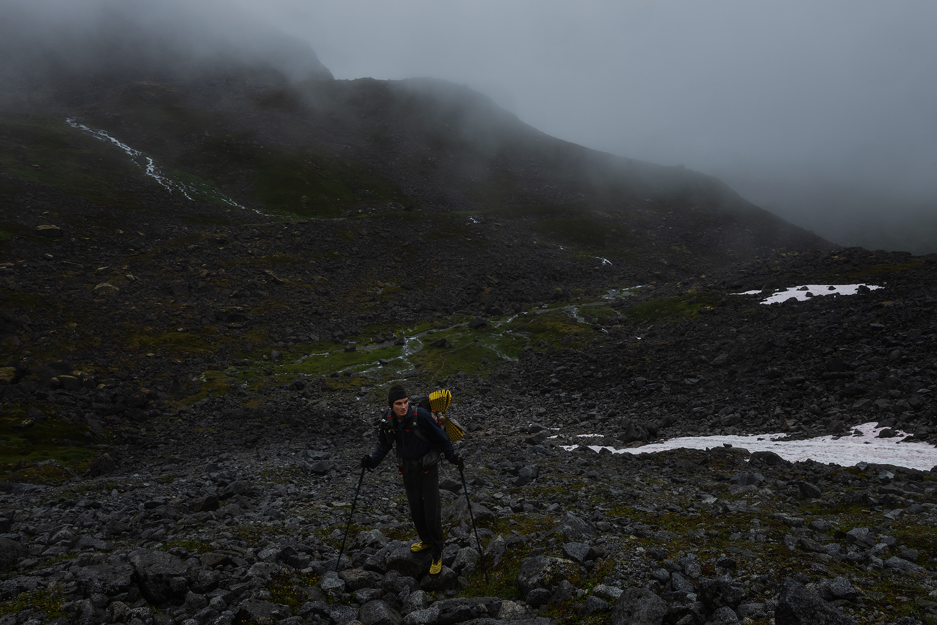
It was still raining upon arriving in the early afternoon, and the trail for the first couple miles was little more than a swamp. After getting more than my fill of walking through murky, shin-deep water while screaming at potential bears, I began the steep 2500’ climb up to a pass near the Snowbird Glacier. Fog enveloped the mountainside, making this section feel quite ominous. Partway up I took an uncharacteristically bad fall and snapped a hiking pole. What a promising start to the trip! I’d read trip reports describing how awful the terrain is on some parts of the route but just assumed it was being exaggerated. Should you decide to come here, be warned that the talus slopes contain some of the loosest, slipperiest rocks imaginable.
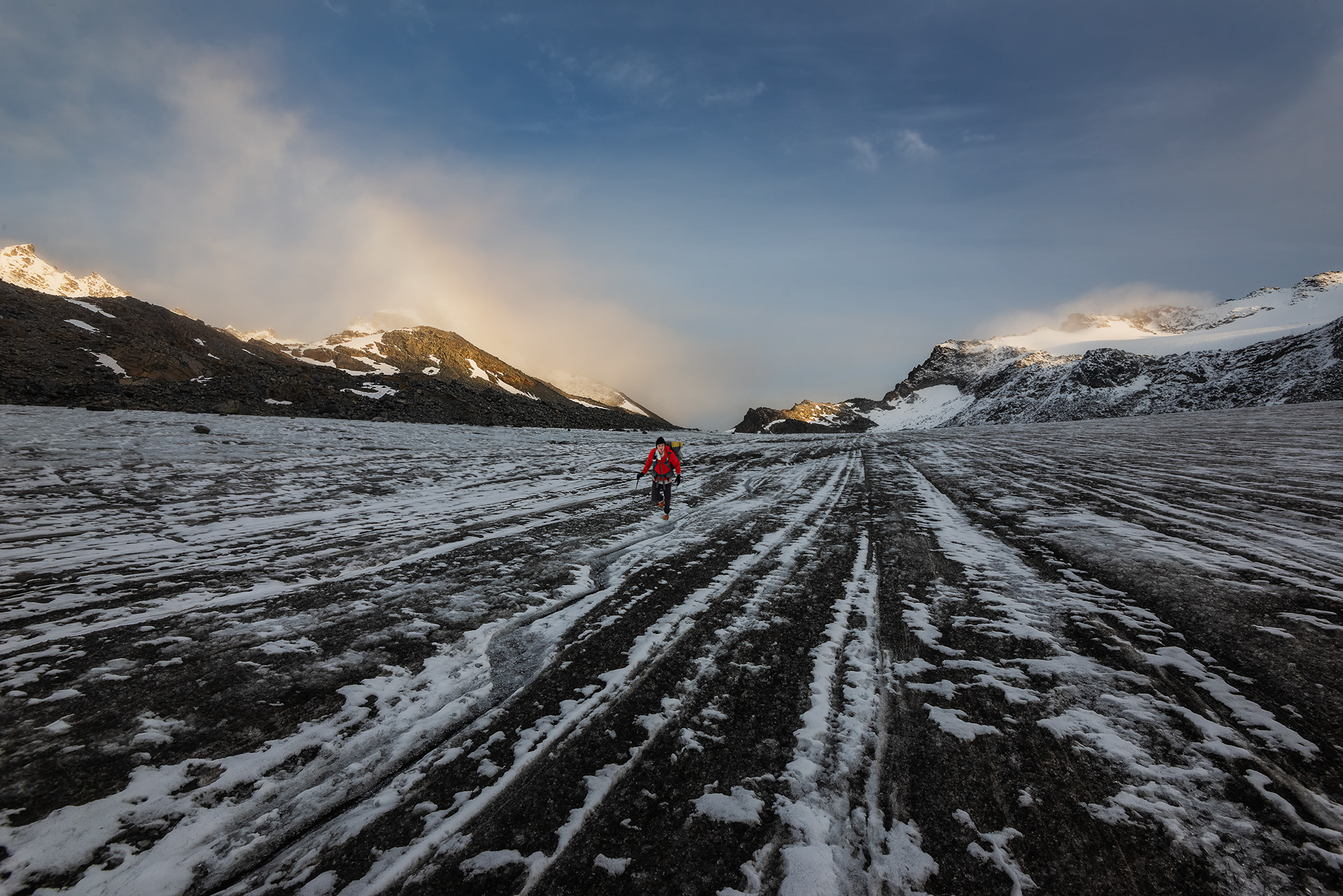
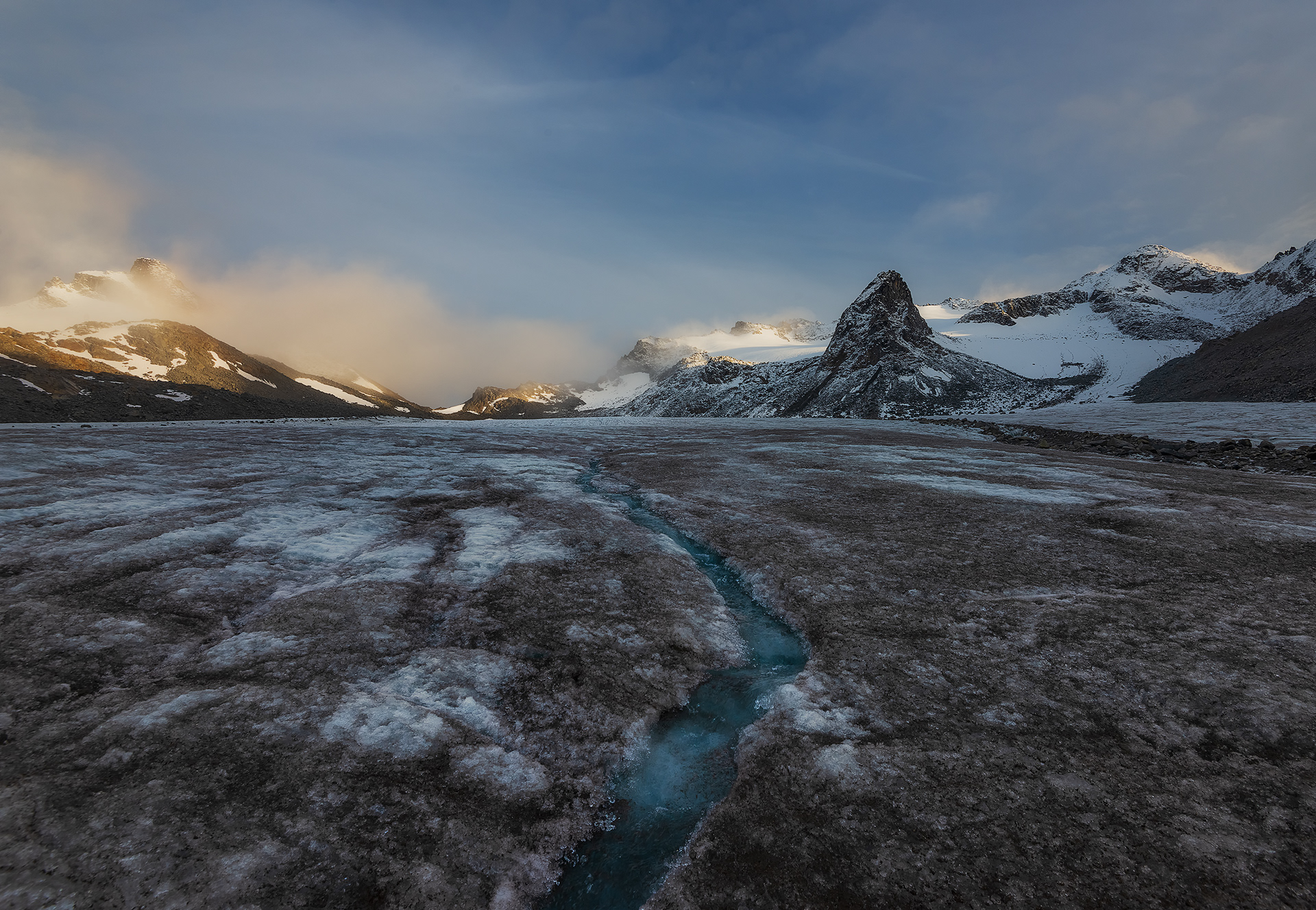
I continued on, making it up to the pass where I donned my microspikes and started walking across the Snowbird glacier. Solo glacier travel is usually ill-advised, but I’d done enough research on the route and had enough visibility that I decided it wouldn't pose any serious risk. One of the most striking features of the Snowbird Glacier is a big nunatak (a mountain sticking up out of glacial ice) aptly named The Nunataq. I also came across a cool crevasse with streams cascading down into the icy depths of the glacier. The weather started to clear up while I was on the glacier making for some great evening light.
After shooting on the glacier for a while, I headed up the moraine to the hut where I stayed that night with two other people and their dog. The light was starting to get really good as sunset was approaching so I quickly dropped my stuff and ran around shooting photos until it was dark out. One of the excellent things about being this far north in the summer is that good light lasts for a long time even after the sun goes below the horizon. Once it was finally dark I prepared my cold couscous, brushed my teeth, and tried to get into bed without disturbing my hut mates. The dog wasn’t having any of that though, and repeatedly woke us up throughout the night.

Day 2
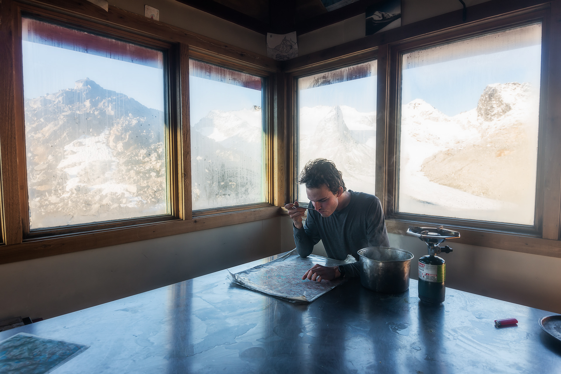
I slept for maybe three or four hours total between dog barks and got up in the very early twilight to go out and shoot. After sunrise I came back inside and chatted with my new friends until they started hiking back to civilization. They had extra food and gave me some lentil soup mix, so I used the hut’s cooking stuff to boil water and have that for breakfast. The hut also had lots of awesome artwork, maps, and journal entries.
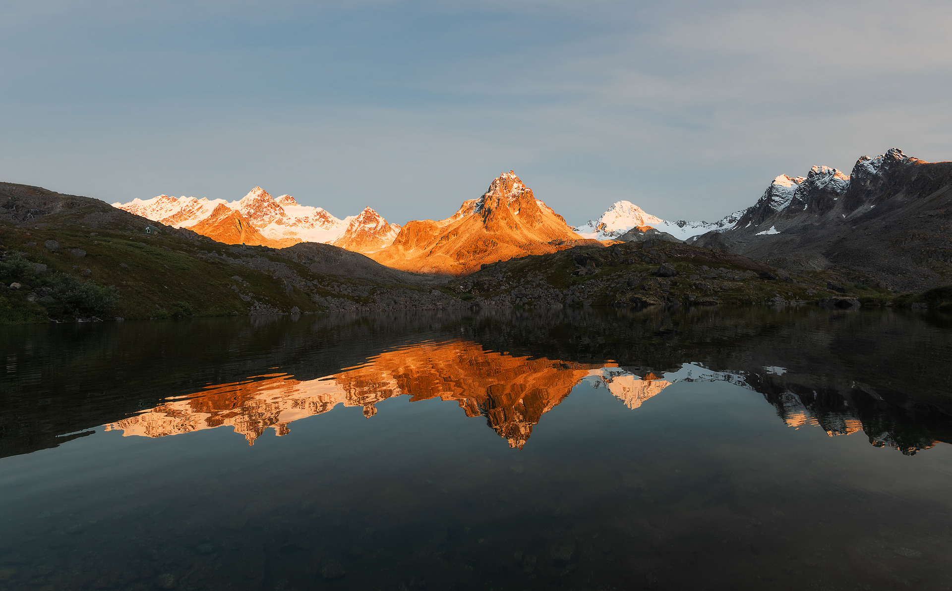
I thought it would be pretty straightforward to get from here to the Bomber Hut. A tedious but inconsequential descent through a series of boulderfields brought me to a lake that I think gets fed by runoff from the Snowbird Glacier. A few minutes past the lake I sat down to eat a snack and stretch for a bit. About half a mile later I reached to check the map on my phone but realized it wasn’t in my backpack’s hip belt pocket where I normally keep it. I searched my entire pack and couldn’t find it, and figured I must have forgotten to pick it up when I stopped earlier. The issue was that I didn’t remember exactly where I’d stopped. I ended up spending the next five hours systematically combing the area until I found my phone in the grass. I was incredibly relieved but also pretty annoyed that it was now 5pm with only a mile of forward progress made that day. I wanted to have time to scout the area around the Bomber Hut before sunset so I started moving pretty quickly. At the bottom of the valley was a tricky stream crossing. If there was a good spot to cross I didn’t find it, and instead ended up slipping and falling waist deep into the glacial meltwater and snapped my remaining hiking pole in the process. Splendid. Once across, I repaired the hiking pole to a semi-functional state and then picked up the pace to try to warm up. Next up was a section of dense alders for a mile or so, through which no trail existed. Lots of bushwhacking and swearing ensued. Another stream crossing presented itself and I promptly fell in for a second time, this time only up to my thighs. The alders eventually gave way to a swamp and I decided it would be easiest to just embrace wet feet and trudge through. I finally arrived at the Bomber Hut a couple hours before sunset and set up my bivy sack outside since a lot of people where already staying in the hut. I scouted around the basin and found a great reflection spot just as the mountains were starting to glow orange. After sunset I further explored the area and found a perfectly still pond with reflections of what I believe was Montana Peak and several other snowcapped peaks. I finally curled into my sleeping bag at about midnight, exhausted from moving almost constantly for 18 hours after having slept just 3 or 4 hours the previous night. Part of me wanted to sleep in, but part of me wanted to get up for sunrise in a few hours to go shoot by another set of lakes further up the basin that I’d marked on the map before the trip. To settle this debate, I asked myself when I would ever be back in this spot with conditions this good, and decided that even though I was exhausted it would never be any easier to get the shot I wanted than it would be now. So I set an alarm for something like 5am, packed my bag for the morning, and went to sleep.

Day 3
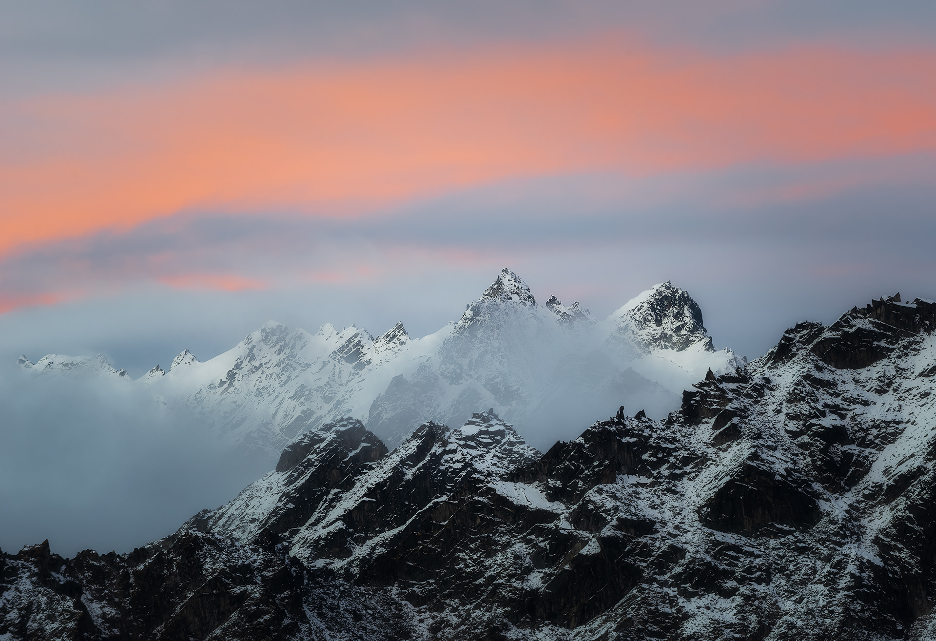
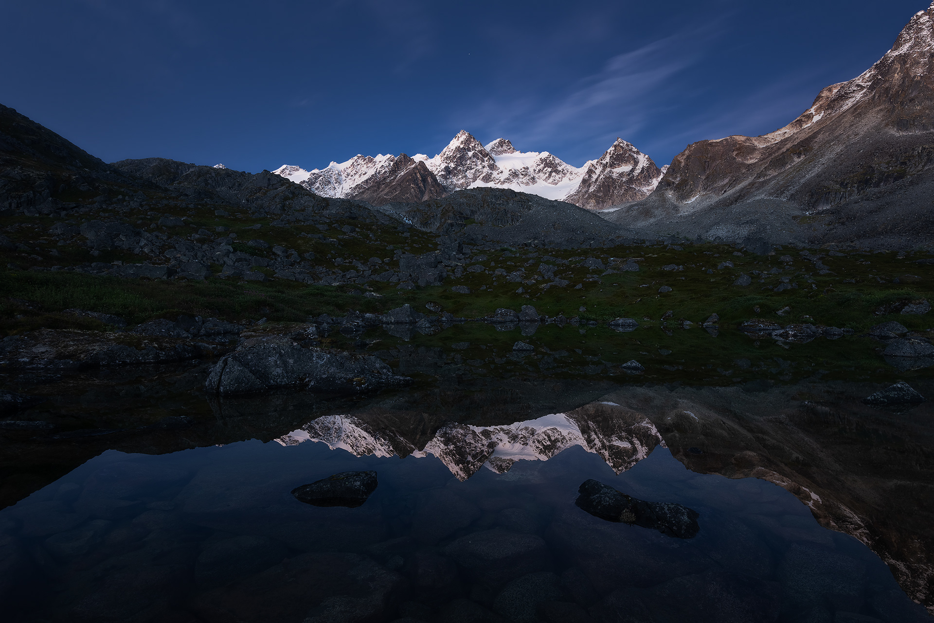
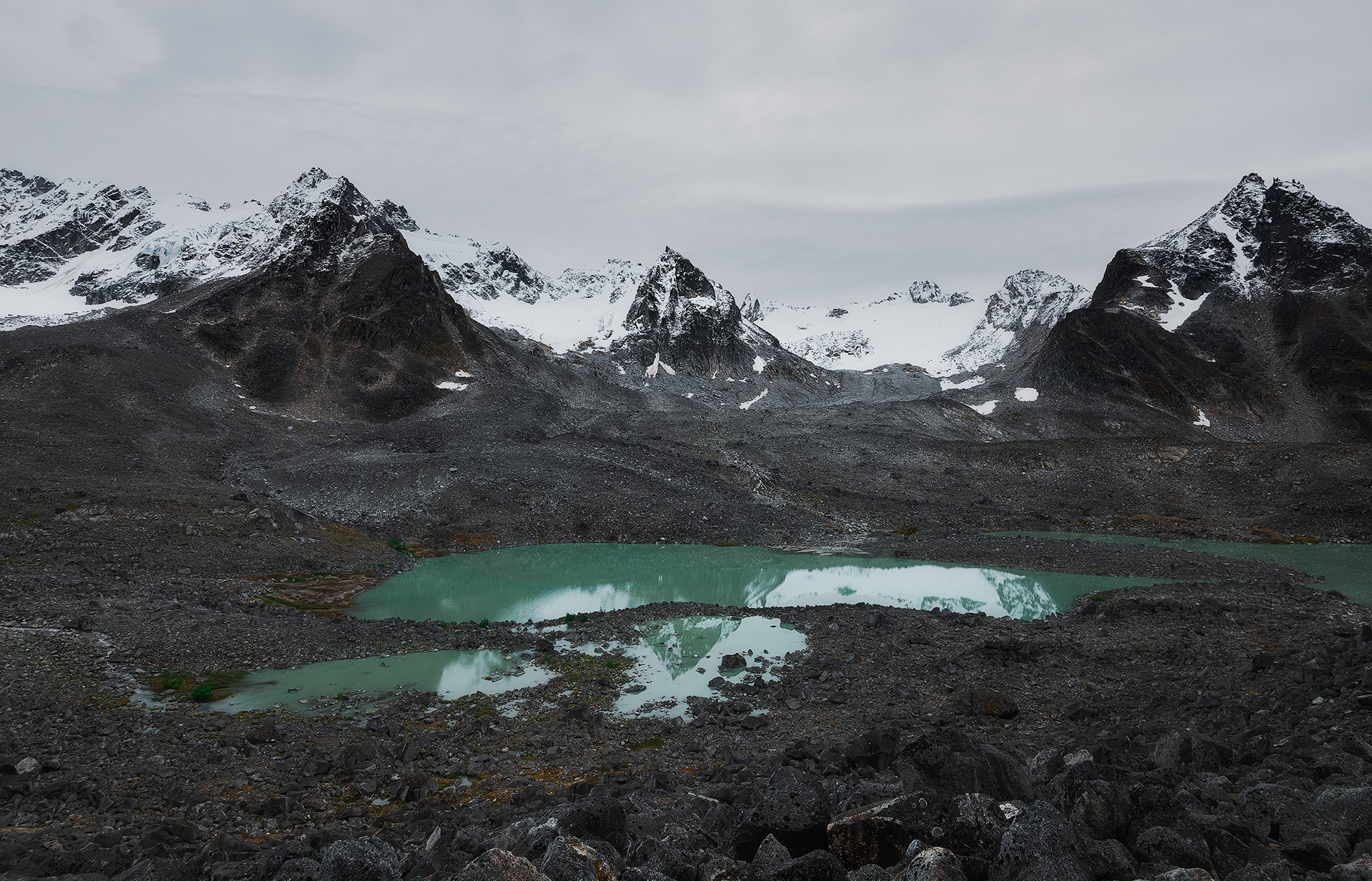
I quickly got out of my sleeping bag after the alarm went off and started walking the mile or so up the valley to the lakes. I got there with plenty of time to settle on a composition before sunrise. The sky lit up for just a couple minutes but that was all I needed. I sat there for a while after sunrise marveling at the landscape and feeling so privileged to be here experiencing this place. I wandered around the area a bit more and came across another cool spot with some glacially fed teal lakes. The overcast sky, jagged peaks, and glaciers made for a very austere and foreboding scene, just the way I like it. The scene reminded me a little bit of the Minarets in the Sierra, but with a vastly more powerful Alaskan twist. I made my way back to the hut, feeling quite pleased with my decision to spend the morning shooting and exploring rather than sleeping. I was considering going to the Seth Holden Hut today but decided it wasn't worth the risks associated with the glacier crossings and the allegedly heinous section around Sobriety Pass. It remained overcast and rained on and off the rest of the day so I just hung out in the hut and talked to some of the other people there, exchanging stories about our lives and various backcountry adventures. One guy told us about some of his friends who like to hang glide deep into the Talkeetnas with a packraft on their backs. Many of the rivers in the range eventually flow out to a road, so they just land by a river, raft out of the range, and then hitchhike back to wherever they parked. My little walks in the mountains seemed quite tame by comparison. I slept in the Bomber Hut that night after a relaxing day and got an entire 8 or 9 hours of sleep.

Day 4
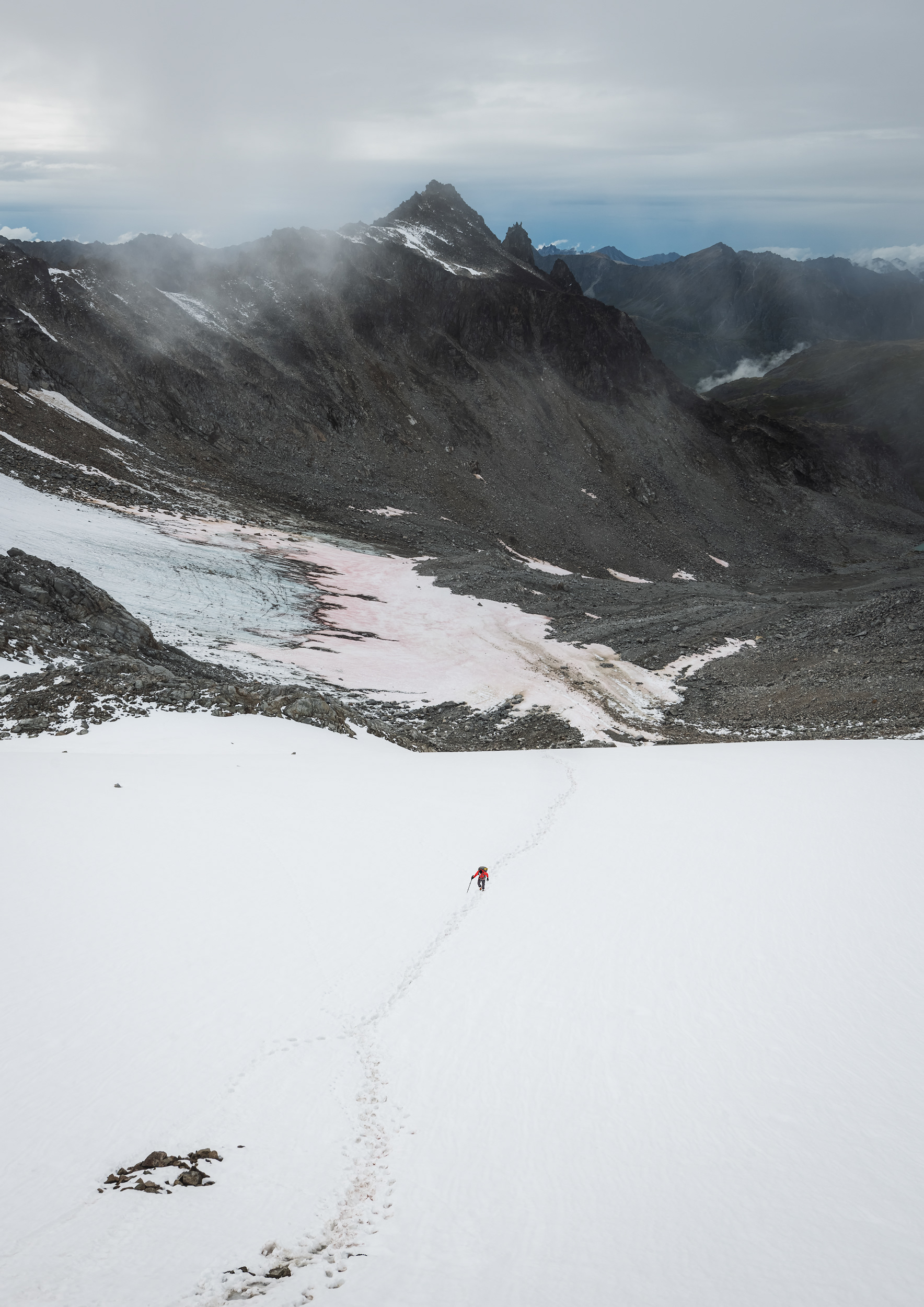
I woke up mid-morning the next day and bid farewell to my new friends before heading up toward the Penny Royal Glacier. This section up to Backdoor Gap was the section that I was most concerned about, but it ended up being pretty straightforward. I donned my microspikes and trash bag gaiters and began heading up the steep glacier. The glacier was covered in some snow but a well-travelled bootpack gave me confidence that I wouldn’t be vanquished by any lurking crevasses or bergschrunds. A rope at the top of the glacier made for an easy ascent up the headwall to the top of the pass.
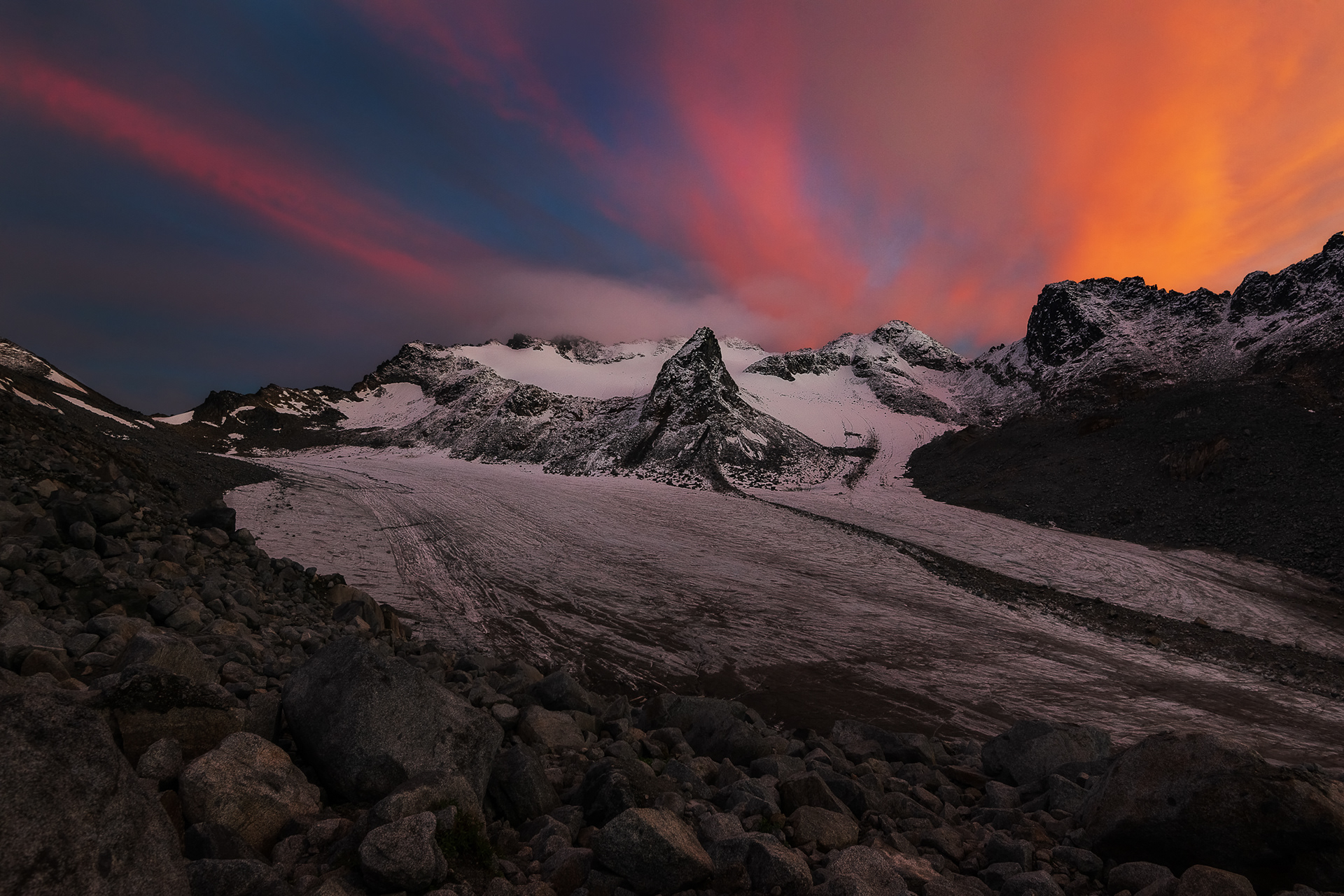
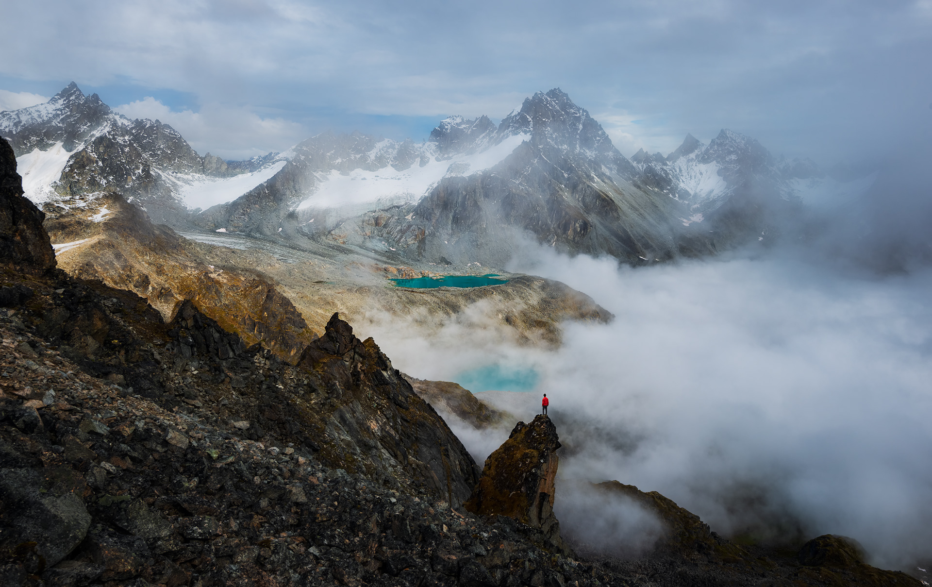
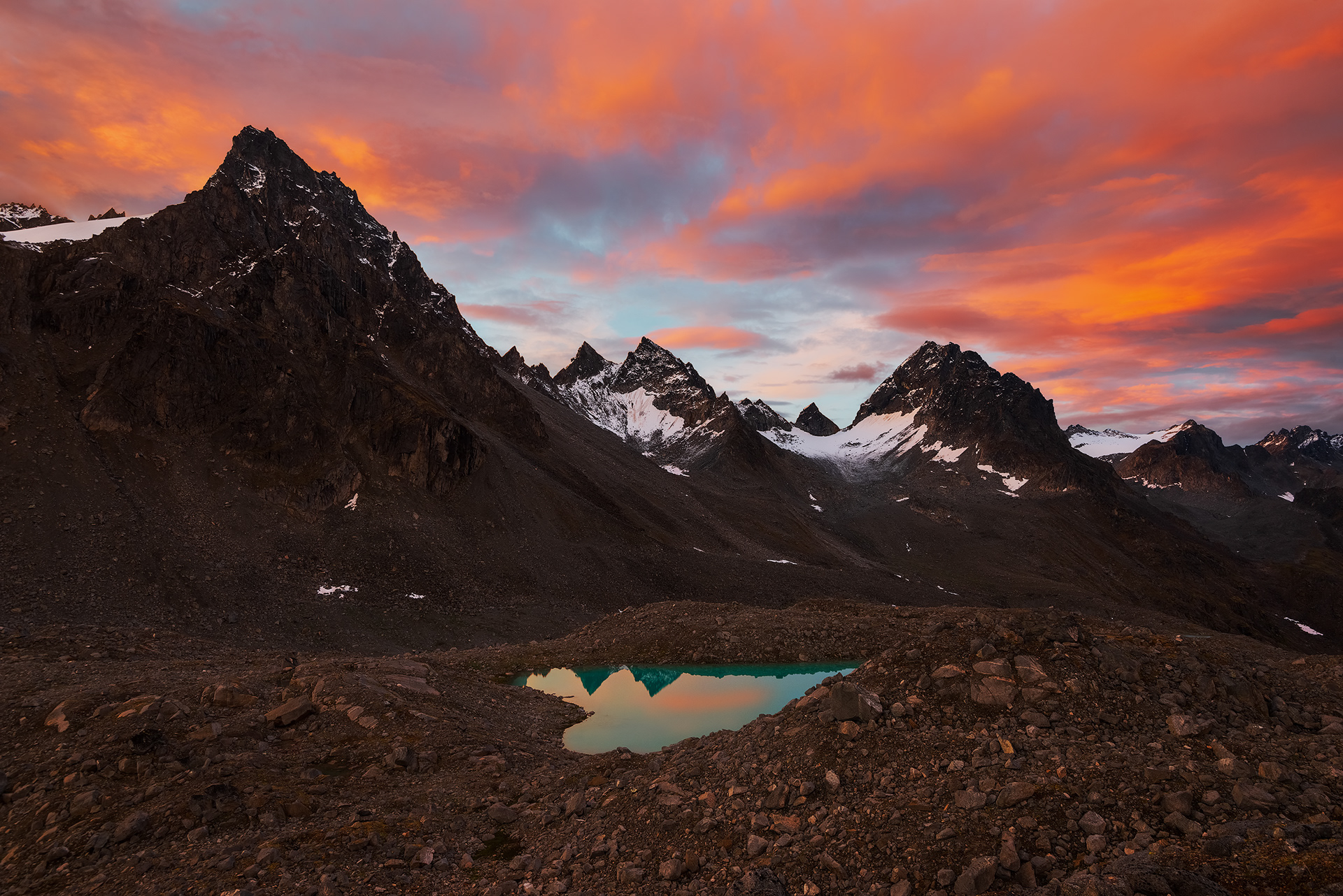
Each hut along this trip seems to be at the heart of its own little sequestered basin surrounded by mountains from some alien planet, and the Mint Hut was no different. From the top of Backdoor Gap, I was greeted with an astonishing view down to Mint Hut, several vibrant blue lakes, and countless jagged spires that I began endearingly referring to as jaggedy bois, as well as a cool view back down the way I came across the glacier. I shot some photos here and then unloaded most of the contents of my pack to do some delightful scrambling. Feeling stoked and ready to head down to the Mint Hut, I could hardly believe my eyes as an insane cloud inversion began rolling up the valley. Plans to descend were quickly abandoned as I set up a phone timelapse and kept shooting photos. Within a few minutes I was enveloped in a cloud. Descending the east side of Backdoor Gap proved rather heinous, especially while in a cloud with only one hiking pole and only one functional knee. My right knee had started seizing up a few minutes earlier when I was scrambling around by the pass, probably as a result of the abuse I’d put my body through over the last couple days along with ongoing IT band tightness. On the descent it quickly got worse to the point where I could barely bend it without severe pain. Hobbling down the loose boulders took an exceedingly long time but I managed without any significant problems. I made it down to the Mint Hut, boiled some water for my couscous, and then went out again to explore the nearby lakes before sunset. The light that evening wasn’t great but I was able to scout the area for the next morning. Cacophonous rockfall intermittently ruptured the silence and echoed off the amphitheater of rock and ice at the head of the valley throughout the evening. The whole drama was overseen by Spearmint Spire towering above the Mint and Troublemint Glaciers and other nearby jaggedy bois. I set up my bivy near Moonstone Lake and was lulled to sleep by the orchestra of the mountains.
Going over the saddle up there
Excellent choice of footwear
How is this real?!
This happened right as I was about to leave
Descending into oblivion


Day 5
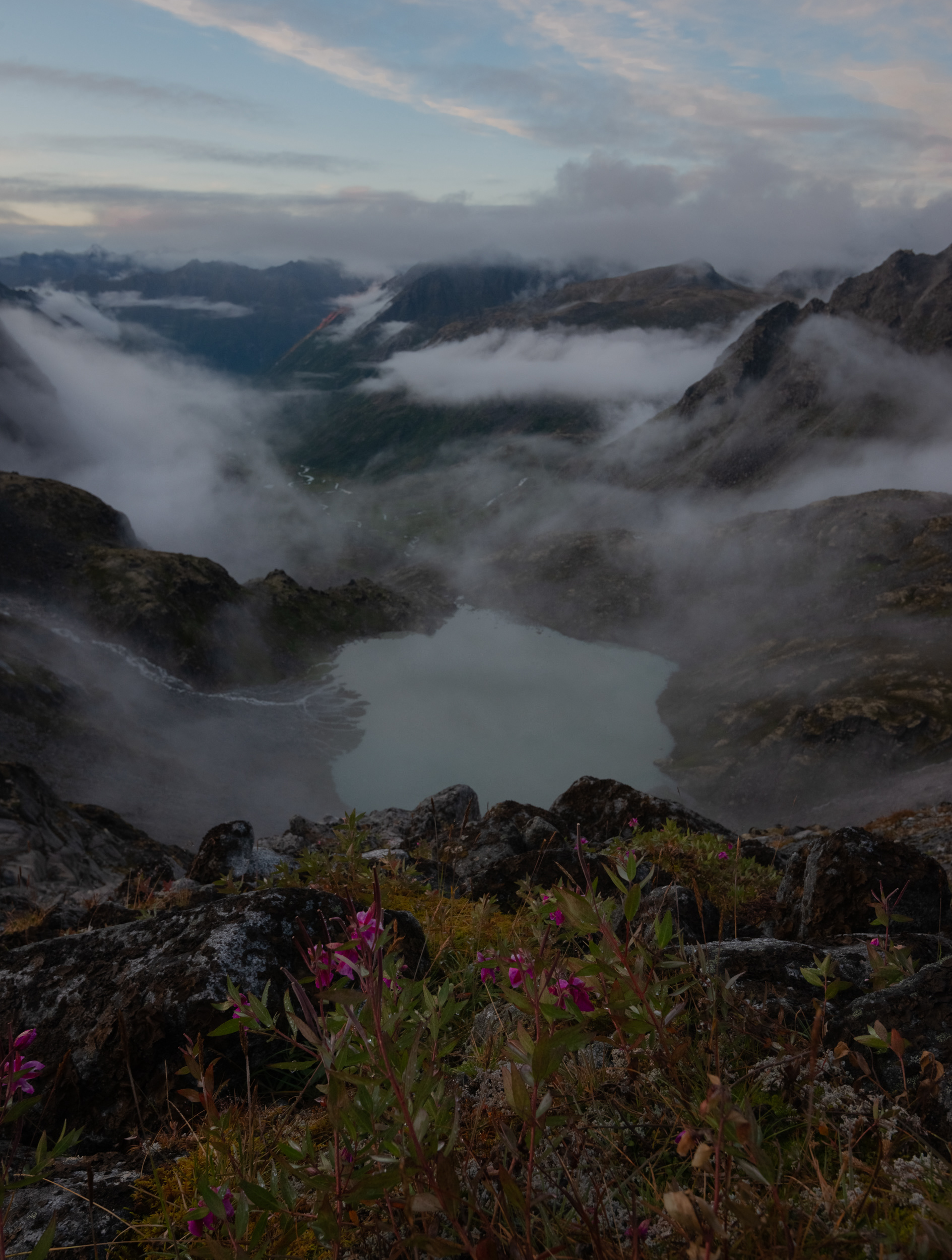
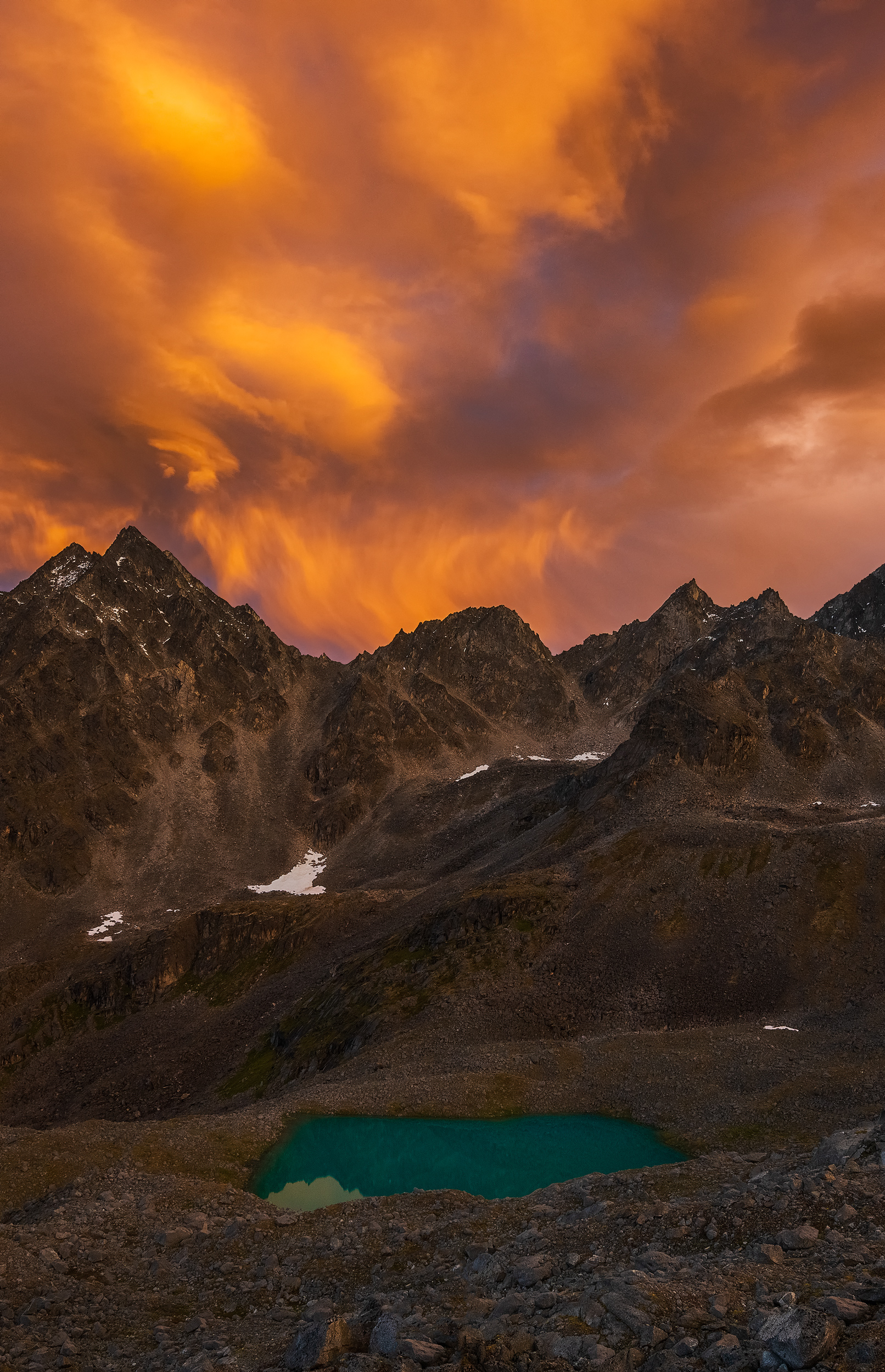
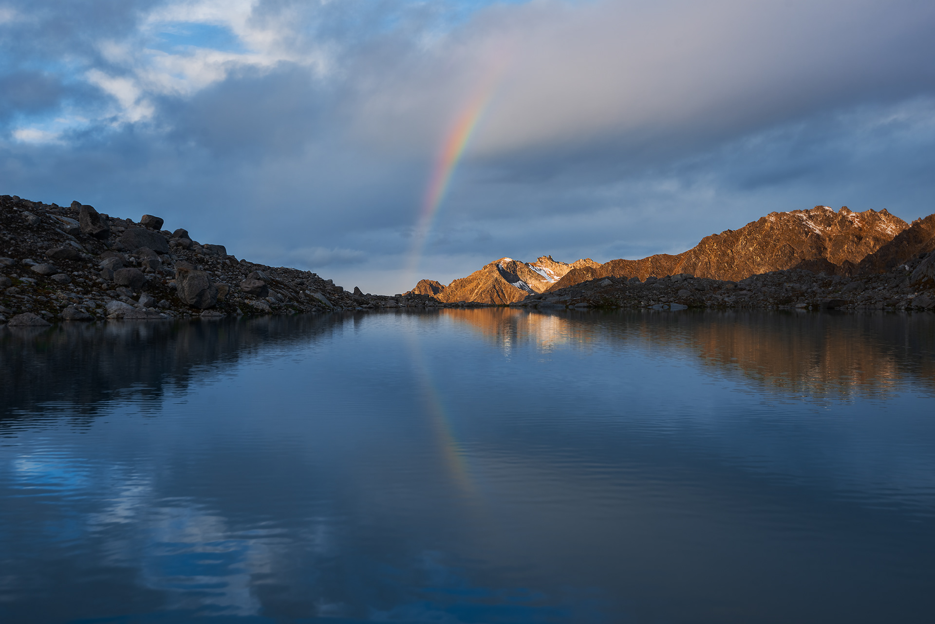
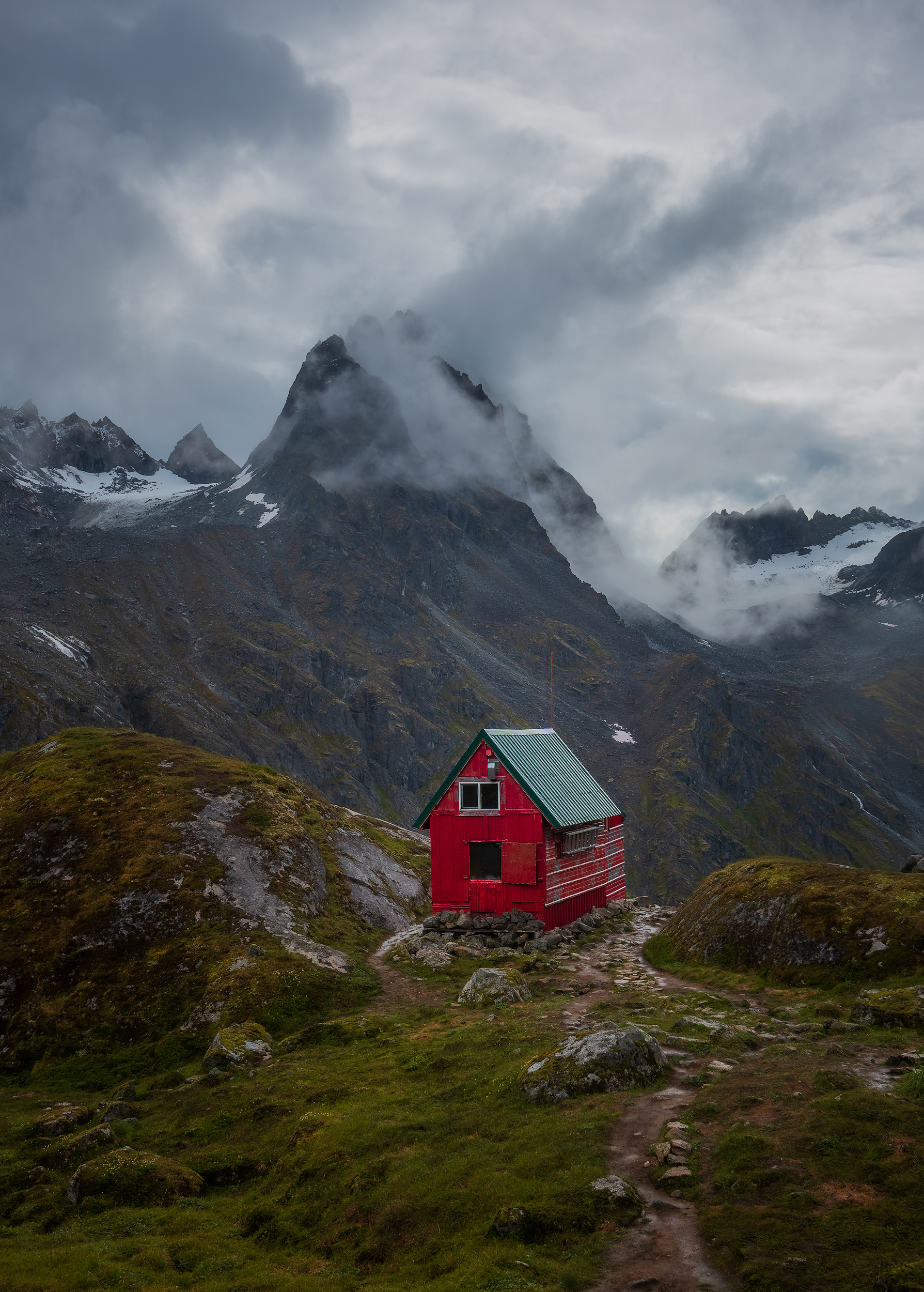
The next morning brought one of the most insane sunrises I’ve ever witnessed. Smoldering clouds morphed across the sky and gradually shifted from pink to orange to yellow as the sun got closer to the horizon. The glassy teal tarns stuck out like jewels in the otherwise-austere alpine rubble. I almost forgot how to take photos and frantically hobbled around shooting as the light changed, hoping that I was making good use of the ridiculous conditions. Just as the show seemed to finally be over, a small rainbow appeared! I’m not sure if this ridiculousness is normal here or if I just got really lucky. Anyway, after offering a hearty sentiment of gratitude to the mountain gods, I packed my stuff up and headed down to shoot some photos of the bright red Mint Hut.
A group of four was hiking from the hut back to the trailhead that day so I tagged along with them for bear safety. It was pouring rain on the entire eight mile hike out, the trail was submerged and/or extremely muddy the whole way, and I ripped apart my rainpants while bushwhacking. What a fitting end to the trip. The route I did was a loop that didn’t end exactly where I started, so the people I tagged along with kindly gave me a ride back to my car at the other trailhead. Although more nonsense in the Yukon awaited, the last of my heinous Alaskan adventures was now complete.

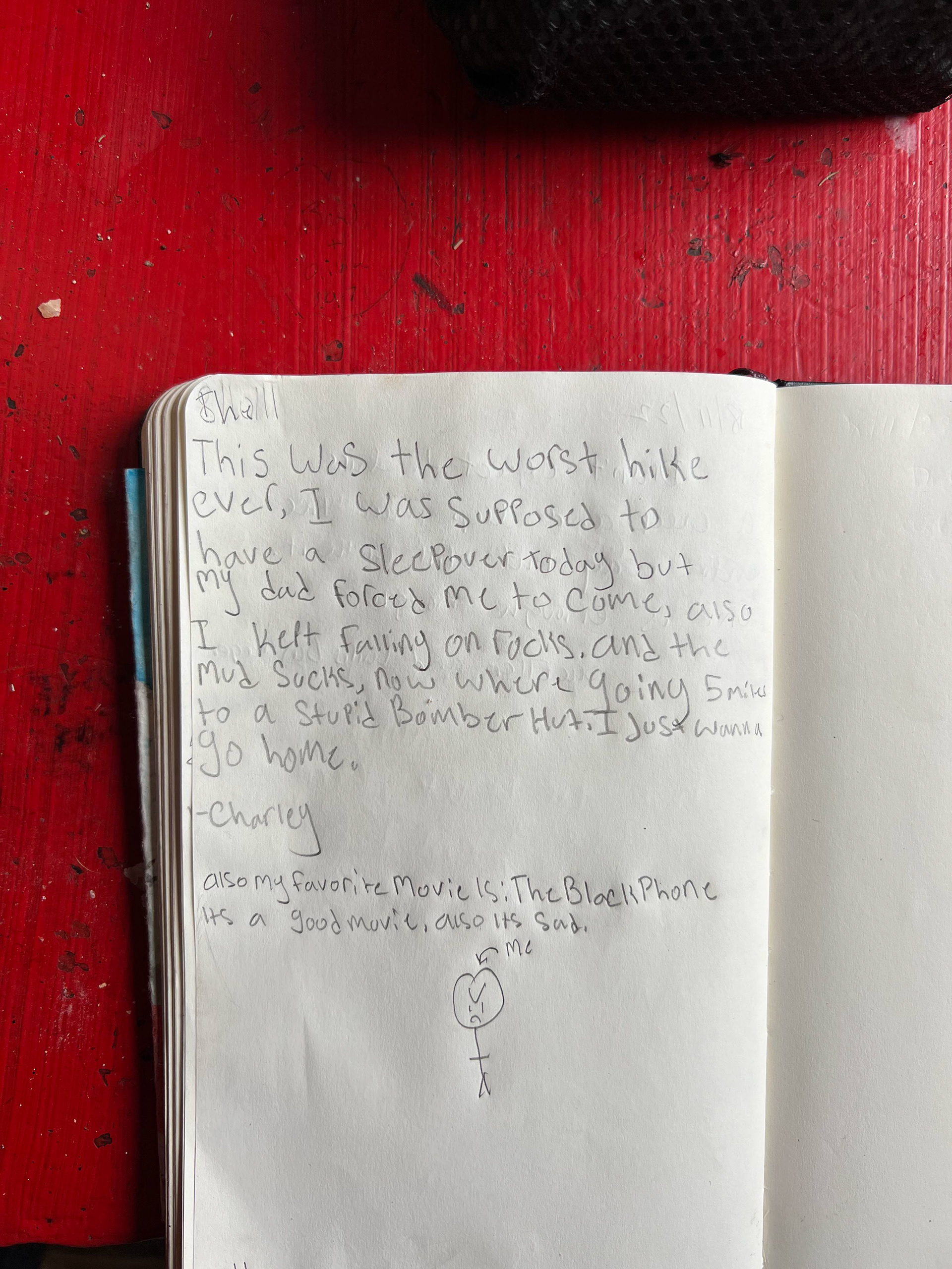
Glowing review in the Mint Hut journal